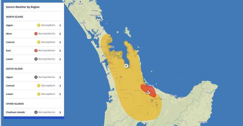
Radar detected severe thunderstorms near Ōmokoroa and the Kaimai Ranges at 5.45pm. MetService expected the storms to move towards Tauranga, Pyes Pā and Ōropi around 6.15pm, then towards Te Puke, Pāpāmoa and Paengaroa around 6.45pm.
MetService warned that torrential rain could flood streets, streams and gullies quickly and make driving hazardous. Its next warning update was scheduled for 6.45pm.
Other areas under a watch
- Upper North Island: A severe thunderstorm watch covered Auckland, the Coromandel Peninsula, Waikato, Bay of Plenty, Rotorua and Taupō until 7.30pm. Localised downpours of 25 to 40mm an hour were possible in parts of the watch area.
- Lower South Island: A separate severe thunderstorm watch covered Dunedin, Clutha and Southland until 7pm.
- Westland: A heavy rain watch covered the ranges around and north of Aoraki/Mount Cook until 9pm.
Check MetService and local road updates before travelling. If you reach a flooded road, turn around. If a storm approaches, take shelter indoors away from windows.