
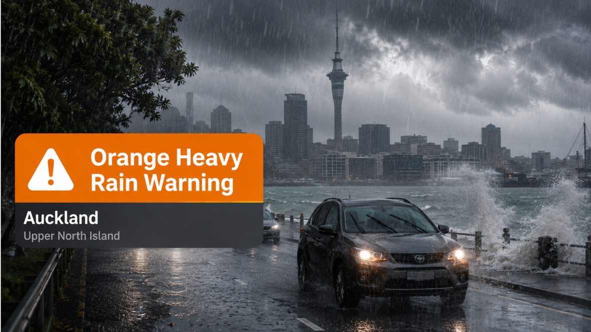
Auckland is now under an Orange Heavy Rain Warning, with rain already falling across the region as the severe weather system moves through the upper North Island.
The latest weather alert being shown for Auckland warns of severe weather associated with heavy rain. Temperatures in the city were sitting around 16°C shortly after midday, with persistent rain affecting the region.
People in Auckland should now treat the conditions as more than simply a wet Saturday. Heavy rain can cause surface flooding, rapidly rising streams, difficult driving conditions and slips in vulnerable areas.
Residents are being advised to clear drains and gutters where it is safe to do so, avoid unnecessary travel through flood-prone locations and keep checking official weather and emergency information throughout the afternoon.
Drivers should slow down, increase following distances and avoid attempting to cross flooded roads.
The warning comes after MetService had earlier placed Auckland under a Heavy Rain Watch, with forecasters advising that rainfall could reach or exceed warning thresholds if localised downpours developed.
Heavy Rain Targets Upper North Island as Avalanche Risk Continues Across South Island
New Zealand is heading through another unsettled weekend, with heavy rain affecting parts of the upper North Island while avalanche risks remain elevated in several South Island alpine regions following days of severe winter weather.
MetService had issued heavy rain watches for Northland, Auckland, the Coromandel Peninsula and Bay of Plenty, with conditions expected to remain unsettled through Saturday.
At the same time, parts of the South Island are still dealing with the aftermath of flooding, slips, road closures and heavy snow, with avalanche warnings remaining in place for several mountain regions.
From here, continue with the existing article starting from your “Weather situation at a glance” table.
One important editorial change: because Auckland has now moved from a watch to an Orange warning, I would also update the Auckland row in your table to:
| Region | Main risk | Current situation |
|---|---|---|
| Auckland | Heavy rain | Orange Heavy Rain Warning in force |
Heavy Rain Targets Upper North Island as Avalanche Risk Continues Across South Island
New Zealand is heading into another unsettled weekend, with heavy rain expected across parts of the upper North Island while avalanche risks remain elevated in several South Island alpine regions following days of severe winter weather.
MetService has issued heavy rain watches for Northland, Auckland, the Coromandel Peninsula and Bay of Plenty, with the watches running from Saturday morning through to late Saturday night.
At the same time, parts of the South Island are still dealing with the aftermath of flooding, slips, road closures and heavy snow, with avalanche warnings remaining in place for several mountain regions.
Weather situation at a glance
| Region | Main risk | Current situation |
|---|---|---|
| Northland | Heavy rain | Watch in place Saturday |
| Auckland | Heavy rain | Watch in place Saturday |
| Coromandel Peninsula | Heavy rain | Watch in place Saturday |
| Bay of Plenty | Heavy rain | Watch in place, some areas at higher risk of warning |
| Queenstown | Flood recovery, avalanche risk | Clean-up continues |
| Aoraki Mt Cook | Avalanche risk | High warning |
| Arthur's Pass | Avalanche risk | Considerable risk |
| Wānaka | Avalanche risk | Considerable risk |
| Aspiring | Avalanche risk | Considerable risk |
| Tongariro | Avalanche risk | Considerable risk |
| Taranaki | Avalanche risk | Moderate risk |
Upper North Island faces heavy rain
MetService says periods of heavy rain are expected across the upper North Island on Saturday.
Rainfall totals may approach warning criteria in some areas and could exceed them locally if downpours develop.
The chance of the current watch being upgraded to a warning is considered moderate for most regions.
For the Bay of Plenty east of the Rangitaiki River, the chance of an upgrade is higher.
Residents are being encouraged to prepare by clearing drains and gutters before the rain becomes heavier.
People in flood-prone areas should also keep an eye on local conditions, particularly if intense rainfall develops over a short period.
South Island clean-up continues
While the focus shifts north, communities in the lower South Island are still recovering from the severe weather that hit earlier in the week.
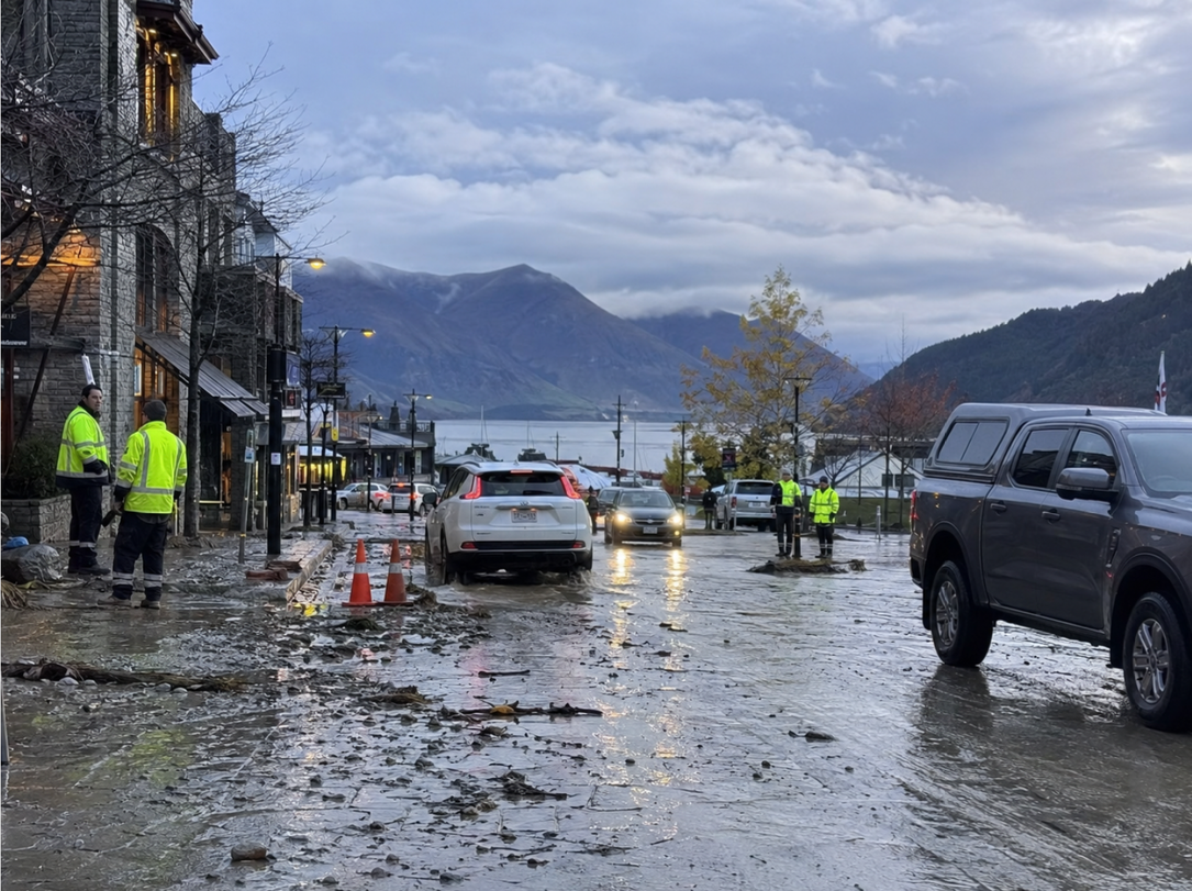
Queenstown was among the areas heavily affected, with flooding, slips and road closures causing significant disruption.
Around 45 people were evacuated from their homes across the Queenstown Lakes District on Thursday night.
Fire and Emergency crews attended about 16 flooding-related incidents across Queenstown, Frankton, Arrowtown, Wānaka and Lake Hāwea.
Queenstown Mayor John Glover said assessments would continue through the weekend as authorities worked to determine when evacuated residents could safely return home.
The Civil Defence Welfare Hub at the Queenstown Memorial Centre remains open.
Avalanche risk remains serious
Although MetService has lifted weather warnings for the South Island, the avalanche threat has not disappeared.
The New Zealand Avalanche Advisory continues to warn of dangerous conditions across several alpine areas.
A high avalanche warning remains in place for Aoraki Mt Cook.
Arthur's Pass, Ohau, Wānaka and Aspiring are under considerable risk, while Queenstown remains at moderate risk.
Mountain Safety Council chief executive Mike Daisley said there had been reports of significant avalanches reaching valley floors.
He warned that the danger is not limited to alpine skiers or people heading into very high terrain.
People planning tramping trips into sub-alpine areas also need to consider what is above them.
Avalanches can travel considerable distances beyond their starting point and can reach areas that may initially appear safe.
Anyone entering alpine or backcountry areas is being urged to check the latest avalanche forecast before leaving.
Tongariro and Taranaki also affected
Avalanche risk is not limited to the South Island.
Tongariro is also under a considerable avalanche risk, while Taranaki is under a moderate risk.
That means people planning weekend hiking or alpine activities in either area should check conditions carefully before travelling.
Road closures continue to cause disruption
Road closures remain another major issue, particularly around Queenstown and Wānaka.
Traffic congestion became severe in parts of Queenstown on Friday after storm damage affected key routes.
Residents in Fernhill and Sunshine Bay reported long delays, with some journeys that normally take only a few minutes taking more than an hour.
Authorities have advised people in some areas to avoid unnecessary travel.
Residents in Fernhill, Sunshine Bay, Queenstown CBD and Frankton Road have also been asked to conserve water.
More than 20 slips were reported on the stretch of road between Lake Hāwea and Makarora.
Two vehicles and their occupants were freed after becoming trapped between slips on State Highway 6 near Wānaka.
NZTA said the affected section of SH6 would remain closed through the weekend.
West Coast recorded more than 300mm of rain
The wider winter storm has already delivered significant rainfall to parts of the South Island.
More than 300 millimetres of rain was recorded around Franz Josef during the event.
Rivers along the West Coast were running high, while snow accumulated across several mountain passes and elevated communities.
State Highways 73 and 94 were among routes affected by snow closures during the storm.
Weekend remains unsettled
MetService says the current storm system is weakening, but the country is not returning to settled weather yet.
Saturday will bring more rain and showers as a complex trough affects central and northern parts of the North Island.
A cold front is also expected to move across the lower South Island.
From Sunday, a strong west to southwest flow is forecast to spread across the country.
That will bring further periods of rain, especially to western and southern regions.
Severe gales are also possible in exposed parts of central and southern New Zealand on Sunday and Monday.
Conditions are expected to gradually improve later on Monday, although showers and strong winds may continue in some areas.
What people should do this weekend
People travelling or spending time outdoors should plan carefully.
Authorities are advising people to:
- check the latest MetService watches and warnings
- monitor NZTA road closures and travel conditions
- clear gutters and drains before heavy rain arrives
- avoid unnecessary travel during severe conditions
- check avalanche forecasts before entering alpine or backcountry areas
- stay away from swollen rivers and unstable slopes
- allow extra time for travel
- follow Civil Defence instructions where required
A weekend of two different weather threats
This weekend presents two very different but serious weather risks.
The upper North Island is preparing for heavy rain and possible localised flooding.
The South Island, meanwhile, is still dealing with storm damage while avalanche risk remains elevated in alpine areas.
The key message is simple: conditions are still changing quickly across the country.
People should keep checking official updates and avoid assuming that the worst is over simply because one warning has been lifted.